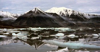
click on image to view the 1990 - Greenland: Kuhn Ø photos...
In August 2000 I went to Kuhn Ø as part of the North East Greenland Expedition organised by the University of Lancaster.
This was my second trip to East Greenland, this time as part of an expedition organised by
the Botanical Dept. of the University of Lancaster. I wasn't doing any science - my Arctic botany
isn't up to scratch - I was just there to make up the numbers. Two other students were on
the trip, and we teamed up and wandered over the island together.
We flew from Iceland to Kuhn Ø and then spent the next three weeks wandering round the island visiting places that looked interesting - not that there was a dearth of inviting places. We reached the 75th parallel which is my current northerly limit.
We were there during August, so the plants had all finished flowering, though there was enough animal life to make things interesting - including an encounter with a polar bear. By the time we left at the end of the month the sun had begun to dip behind the hills on the horizon so we got to see some fantastic sunsets, and the temperature dropped to about -10°C at night.
Some of the points marked on the map as follows:
- Sirius Camp (Camp 1) - Site of the Sirius hut and airstrip.
- Fligleys Fjord - Fjord separating the island from the mainland. We had an inflatable boat with us, and the plan was to cross the fjord and visit the mainland. But the inflatable wasn't serviceable
- Bastians Bught - A sheltered bay where we sat out a force 8 storm
- Boneheid - The highest hill we climbed on the island
- Mt Tango - Another hill we climbed
